
Photo: © Video screenshot
A parrot on the shoulder, an eye patch, a wooden leg and a treasure map are the classic image of a pirate. And if a historian can put up with this well-known marine paraphernalia, then with maps … But that’s another story.
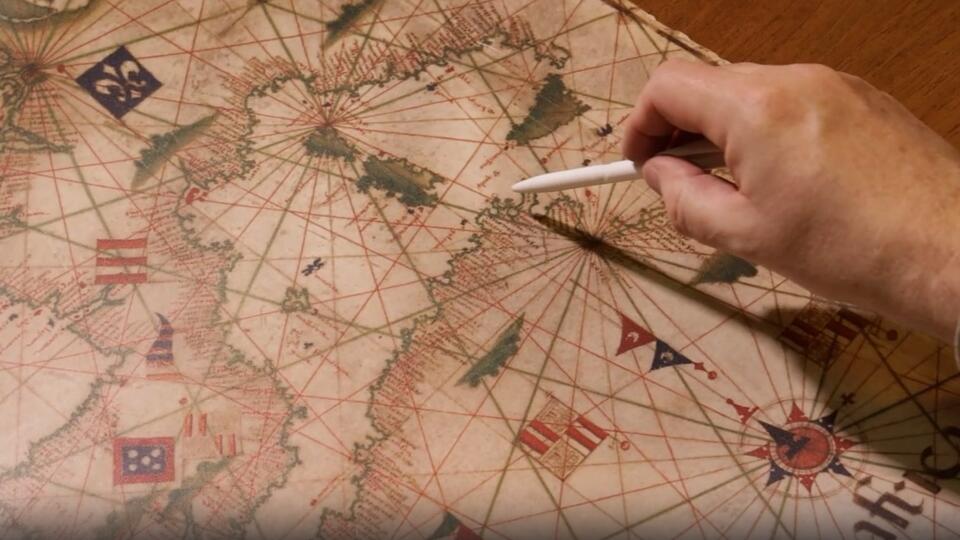
Portolan is a nautical chart of those times. The video shows a copy of it: of course, not made of sheep’s skin, as it was in reality, but even of the same size – 60 meters.
Have you ever wondered how the navigators of the middle and even later centuries managed to stay on track? Forget about the stars, and if it’s cloudy – and for long weeks? For reference: maps resembling modern ones appeared only at the end of the 18th century. Let’s take a look at these portolans. Talks about it program “Unknown History” on REN TV.
Portolan – an invaluable map for sailors
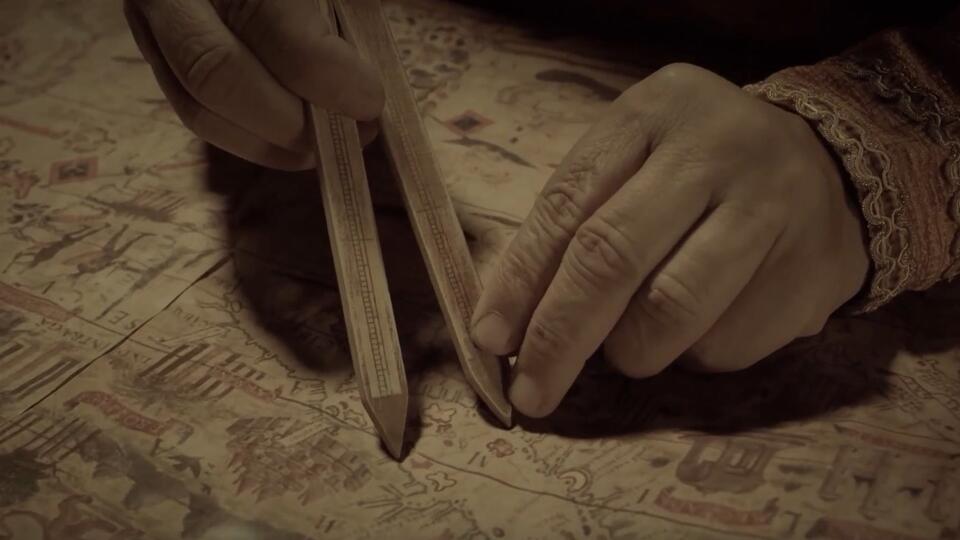
Black, red, and green ink, quill quills, a penknife, a pencil, and some rulers were the set of a cartographer working on a portolan, a chart exclusively for maritime navigation. The so-called rhombus grid helped the sailors to navigate along the way: as a rule, it was drawn for 16 or 32 main directions, along the cardinal points. Rumba lines, coupled with a magnetic compass, allowed the captains to plot routes with maximum accuracy.
“If we are going to sail, for example, from Corsica to Tunisia, we must determine the rhyme that should be guided. Well, in this case, our rhyme is south and southeast, which we can find on the map thanks to the wind rose. We we see that our navigation should go along the coast of Corsica, Sardinia, and then – along the shortest distance to Africa”, – said Vladimir Bulatov, senior researcher, curator of the cartography fund of the State Historical Museum.
For the 13th century (it was then that portolans appeared), this was a real find. Such a map and compass was enough to make the fastest sea route or determine the distance between ports.
“If, for example, we are going to sail from the same Corsica to the Balearic Islands, to Mallorca, then again we must determine the rhumb (in this case it will be west, southwest), take it and hold it. Naturally, what needs to be said about portulans. We now determine the azimuth with very high accuracy – not even up to a degree, but up to minutes, sometimes up to seconds, and portolans do not give such accuracy, they give an error of several degrees of navigation, “- shared information expert Bulatov.
How portolans were made and what was depicted on them
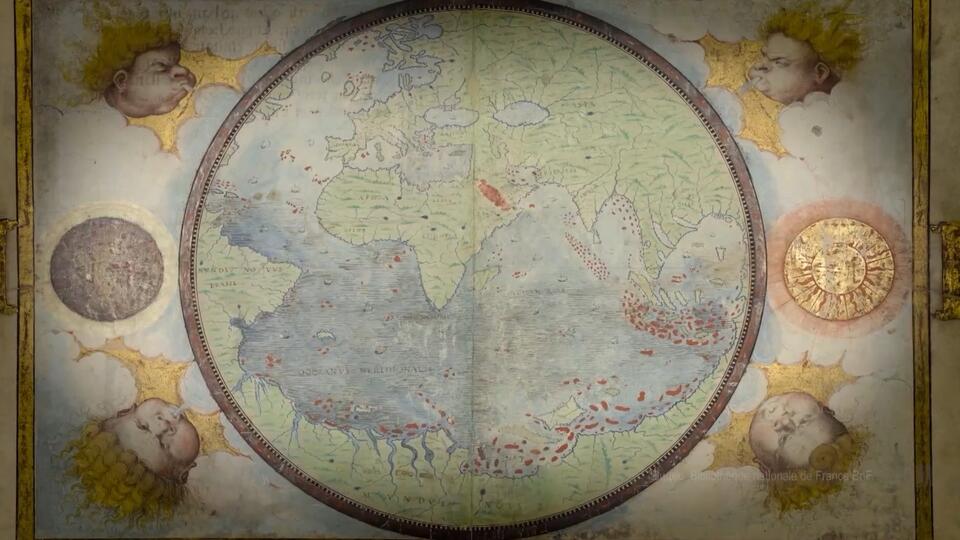
As a rule, portolans depicted the waters of the Mediterranean and Black Seas, the coast of the Atlantic Ocean, the territory from the Iberian Peninsula to Flanders, including the southern coasts of Ireland and Britain. The accuracy with which medieval craftsmen marked seas and coastlines surprises even modern cartographers.
“When we compare portolans with typical maps of the world of the Middle Ages, the difference in accuracy and detail is striking. So striking that some historians believe that medieval cartographers simply could not draw such maps. In their opinion, portolans are a copy of lost prototypes made by a certain ancient civilization. However, there is no historical evidence in favor of such an incredible claim, “- Joachim Gaspar, a professor at the University of Lisbon, said.
For the manufacture of purtulans, specially dressed sheep, goat or calf skin was used. When the card was ready, it was rolled up for easy storage. Sometimes the finished portolan was cut into 20-25 sheets and stitched into a practical atlas book.
Portolans as a state secret
Far from every sailor could afford portolan. Compass charts were quite expensive, not so much because of their handiwork, but because of their strategic value. Portolans were considered almost the most valuable document in the trade business and therefore were carefully guarded by the authorities. In Spain and Portugal, it was generally not worth mentioning the names of these cards aloud: any information related to their production was classified as a state secret.
“The Portulans were protected by the state to the extent that the state benefited from these trading operations. If these trading operations were organized not by the state, but by private companies, then these private companies themselves sought to keep everything secret. Say, Spain kept its way to India, Bulatov said.
Historians believe that the total circulation of portolans was measured in thousands of copies. But no more than 500 have survived to this day.
Pisa map
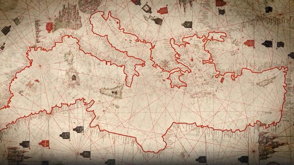
On the published frames – the oldest of the surviving samples – the Pisa map. It was drawn about seven centuries ago. There are over a thousand different locations marked here. Sardinia and other islands of the Mediterranean are depicted in the most detail – these lands served as an important guide for the captains.
But Britain is applied roughly and with errors. Of all the English cities, the cartographer marked only six, including London.
“In the 13th century, this map was not some academic subject where abstract knowledge is disseminated – it was a purely practical thing. If people do not swim somewhere, these places may not be shown: not because they are unknown, but simply because they are not needed in this case by the people who made this map,” shared the expert Bulatov.
Portolan mysteries: where did the places come from that people could not know about
But sometimes places appeared on portolans that medieval cartographers simply could not know about.
The program showed a surviving fragment of the famous map of Piri Reis, created in 1513. The author of the portolan is the Turkish admiral and amateur cartographer Muhyiddin Piri Bey, also known as Piri Reis.
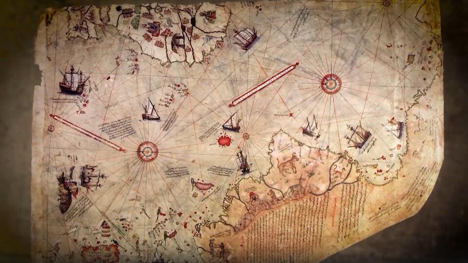
“The portulan of Admiral Piri Reis is based on information from 20 ancient maps. Among them are maps of Ptolemy, Portuguese and Arabic sources, a certain lost map of Christopher Columbus, the original of which was never found,” – Biblical scholar Michael Heiser said.
Piri Reis admitted that he himself had not been to those lands that he depicted. But he quite accurately managed to convey the outlines of both South and North America. In addition, parts of the western coast of Europe and North Africa, as well as various islands of the Atlantic Ocean, are clearly visible on the map. But the main mystery of this portolan is connected with Antarctica. Piri Reis depicted the southern continent of the Earth almost 300 years before its discovery.
“What is even more interesting is that the Antarctic ice is not shown on the Piri Reis portolan. Although, according to official science, Antarctica was covered with ice more than 6 thousand years ago,” noted the biblical scholar Heiser.
Such an image of Antarctica Piri-ries could only see on a map created in the Neolithic era. But, as far as is known, there were no such sources at the disposal of the Turkish admiral.
How Piri-ries learned about Antarctica and why he depicted it without an ice cover is still a mystery. However, some scientists argue that the continent depicted on the map is not Antarctica at all. Most likely, the Turkish admiral simply painted an abstract piece of land.
“We are used to the fact that if a person who makes a map does not know something about some territory, he does not write anything there, leaves a white spot. But they didn’t do that. In the days of Piri Reis, even if a person did not know anything about a certain territory, he still painted something there, “- said the expert Bulatov.
What came to replace the portolans
Portolans gradually disappeared towards the end of the 16th century. Over time, they were replaced by printed cards. Their production cost several times cheaper.
“Moreover, the popular idea that portolans are incredibly accurate is not true. Although the general outline of the Mediterranean Sea with its bays, capes and islands is easily recognizable, a closer look at their general geometry reveals important inaccuracies.” – said Joachim Gaspar, a professor at the University of Lisbon.
Modern sailors rely entirely on satellite navigation. And instead of paper ones, electronic cards are increasingly being used, which allow you to adjust the course in a matter of minutes.
Different versions of historical events, amazing episodes of history, little-known facts and interesting theories – watch all this and much more in the Unknown History program with Boris Ryzhov on REN TV.
Source: Ren.tv
Alfred Hart is an accomplished journalist known for his expert analysis and commentary on global affairs. He currently works as a writer at 24 news breaker, where he provides readers with in-depth coverage of the most pressing issues affecting the world today. With a keen insight and a deep understanding of international politics and economics, Alfred’s writing is a must-read for anyone seeking a deeper understanding of the world we live in.