
Hurricane Lee “soared” in intensity Thursday, transitioning into a Category 5 storm just before 11:00 pm ET before weakening slightly to a Category 4 storm on Friday morning, according to the National Hurricane Center (NHC).
The NHC predicted that a powerful hurricane will move far north of the Leeward Islands and Puerto Rico. and may slow down east-northeast of the Bahamas this weekend. The hurricane’s core is expected to move north of the northern Leeward Islands. Virgin Islands and Puerto Rico this weekend and next weeksaid the NHC on Friday at 5:00 pm ET.
The NHC stated thatThe biggest risk for Lee in the coming days will be high seas and dangerous waves.Rip currents are expected to begin affecting parts of the northern Caribbean on Friday.
Authorities in Puerto Rico have issued an alert as Hurricane Lee’s passage to the north of the island is expected to have 12 to 15-foot waves and strong sea currents.
“Lee’s center is expected to move well north of the Leeward Islands, the Virgin Islands and Puerto Rico this weekend and early next week,” San Juan’s National Weather Service (SNM) said on X (formerly Twitter) on Tuesday. . .
The Puerto Rico Meteorological Agency also warned that “dangerous surf and life-threatening rip currents are likely in the northern Leeward Islands starting today.”
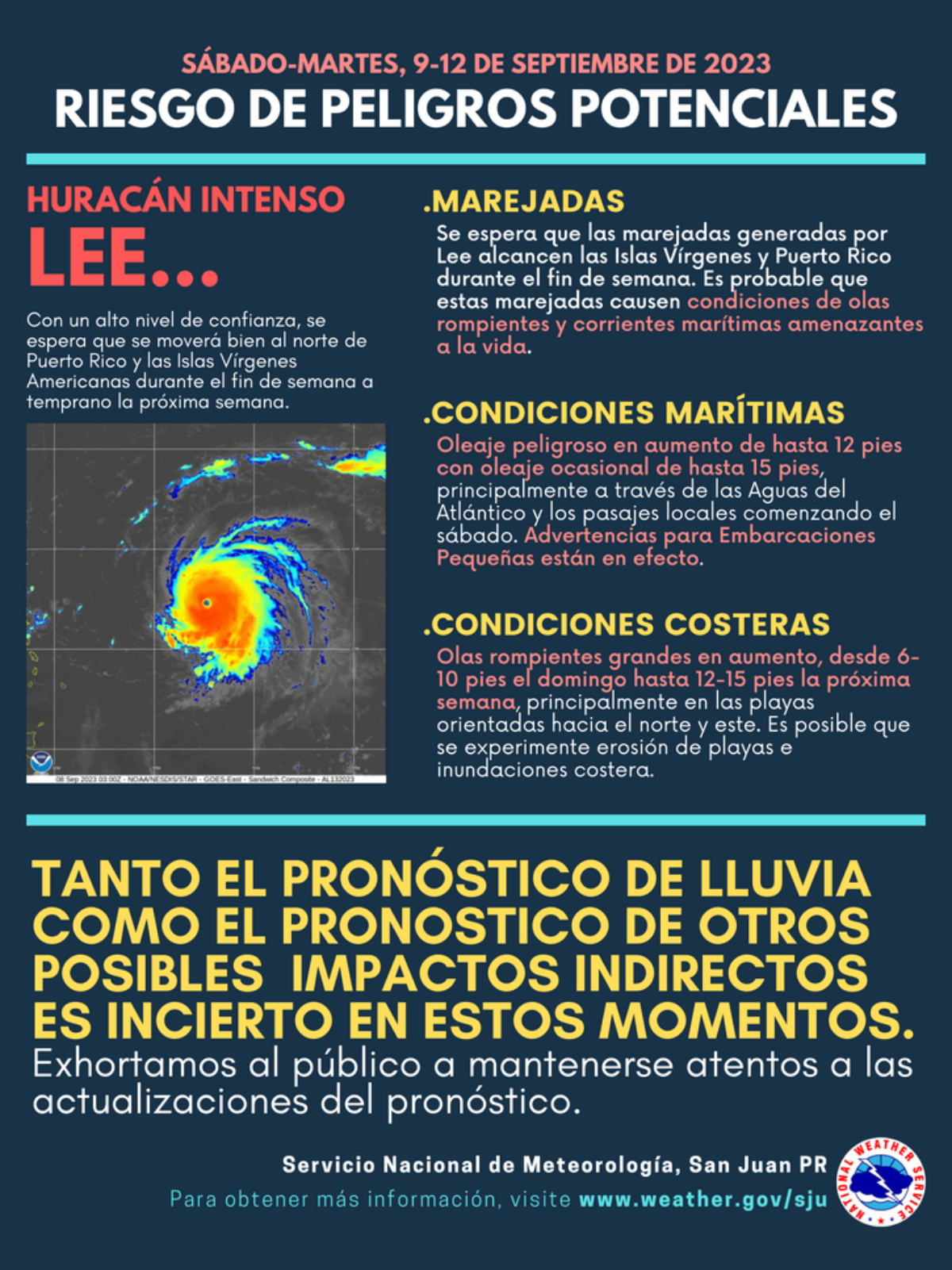
These conditions will spread west and north, affecting Puerto Rico, Hispaniola, the Turks and Caicos Islands, the Bahamas, and Bermuda over the weekend.
As a result, the Coast Guard urged boaters in Puerto Rico and the Virgin Islands to exercise caution due to deteriorating sea conditions due to Hurricane Lee.
Source: La Opinion
Alfred Hart is an accomplished journalist known for his expert analysis and commentary on global affairs. He currently works as a writer at 24 news breaker, where he provides readers with in-depth coverage of the most pressing issues affecting the world today. With a keen insight and a deep understanding of international politics and economics, Alfred’s writing is a must-read for anyone seeking a deeper understanding of the world we live in.